Val d'Ayas

Champoluc

BLUE LAKE - short tour

The shortest hike to the most popular excursion destination in the upper Ayas Valley

By: Comune di Ayas

Route category: Trekking

Duration: 2 hours 40 minutes

Difficulty: Medium

lago blu

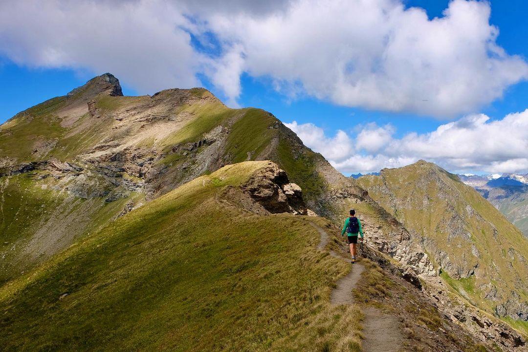
This itinerary is certainly one of the best known and most popular routes in the Val d'Ayas.

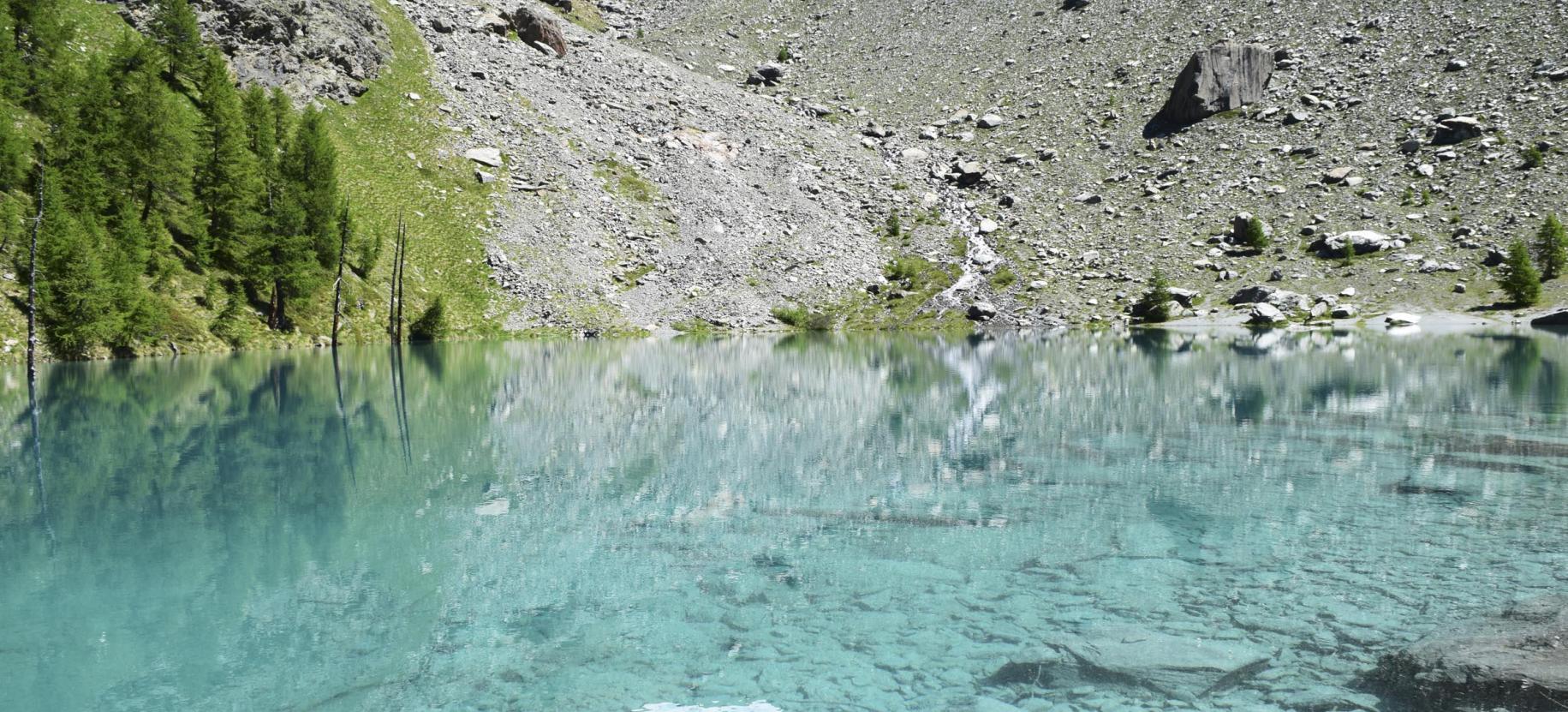
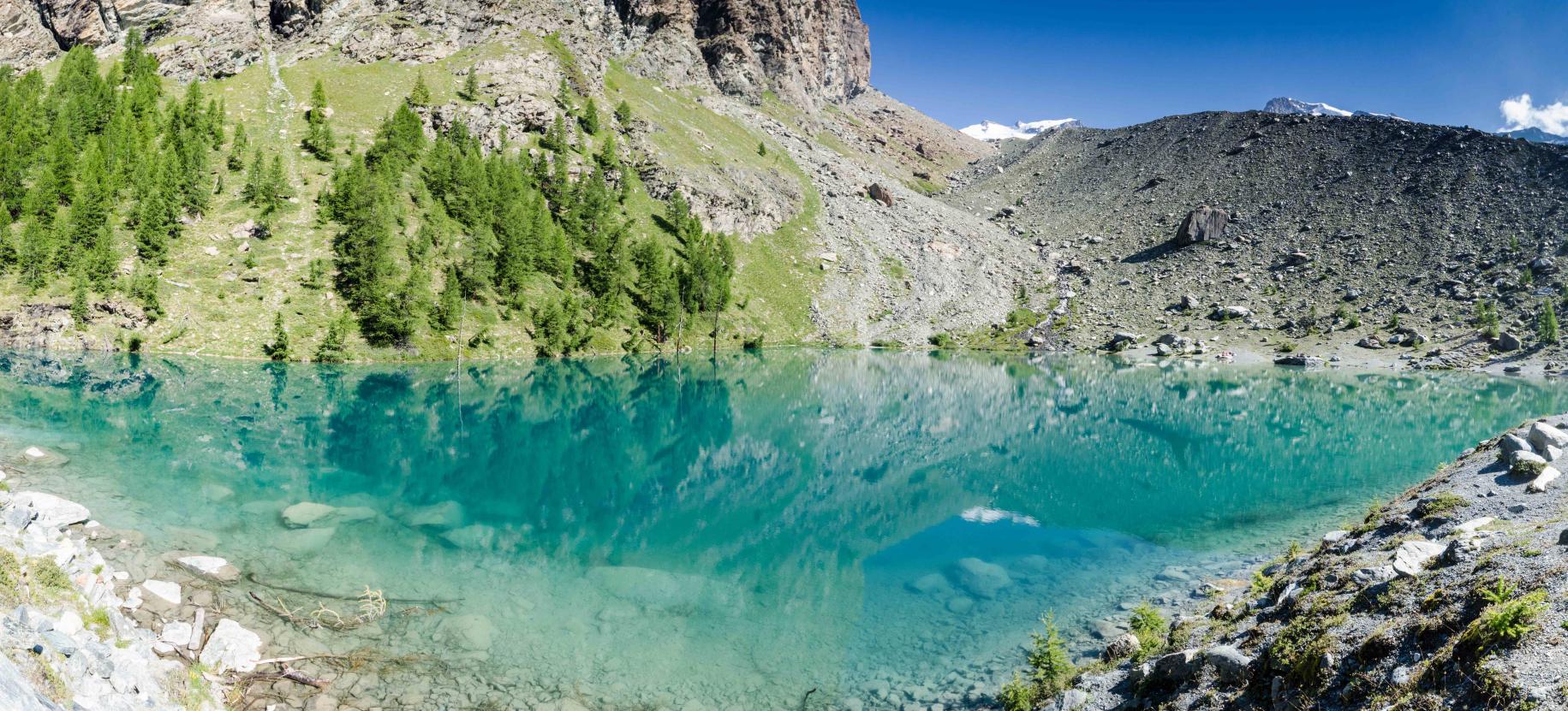
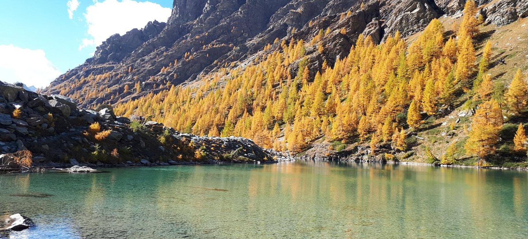
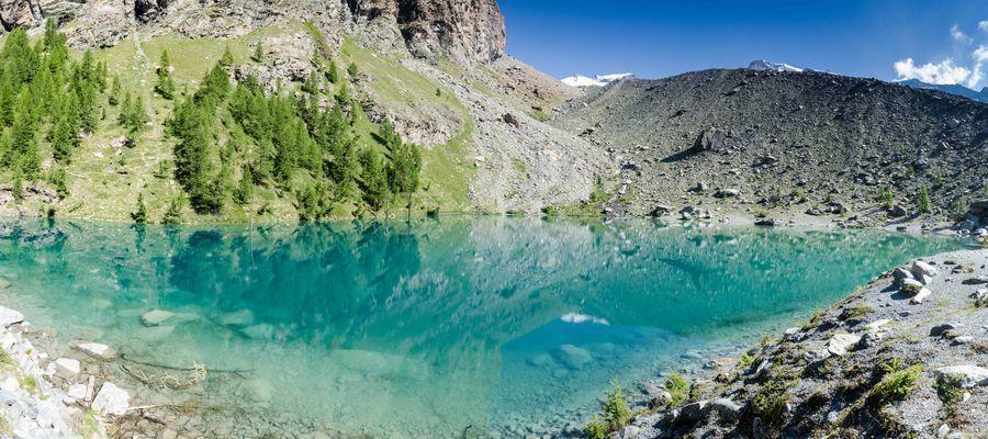
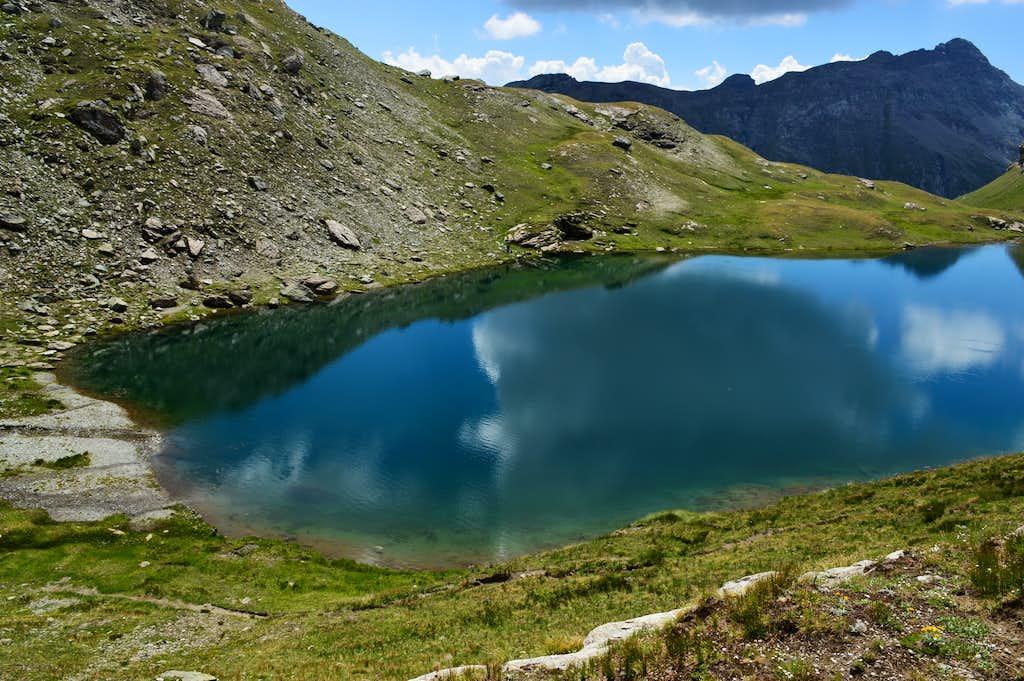
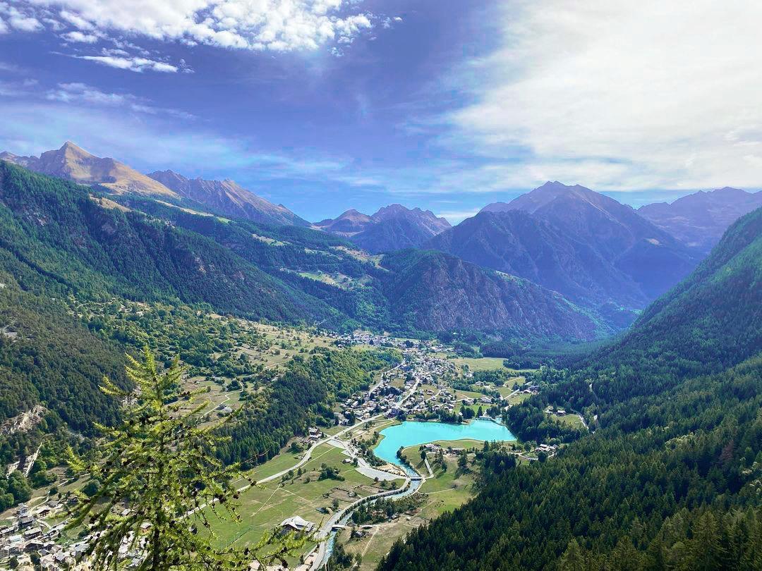
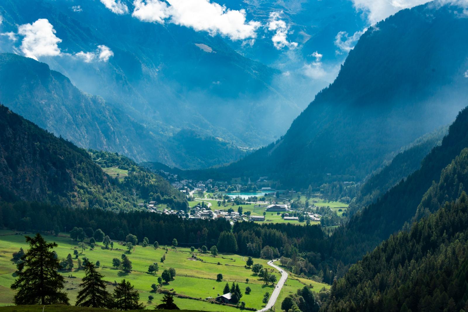
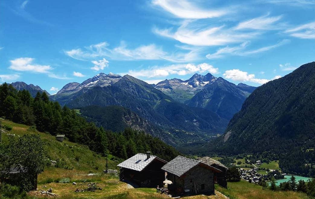
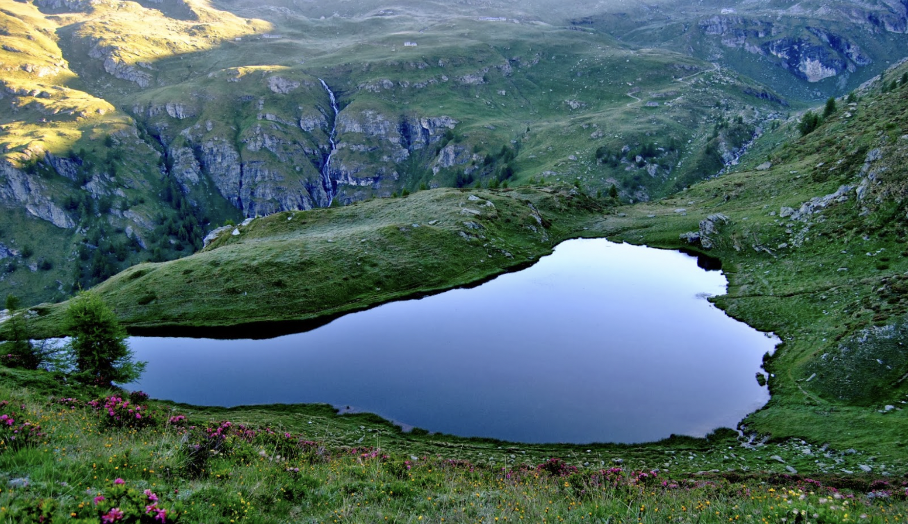
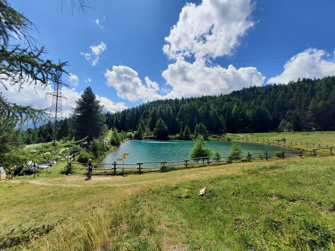
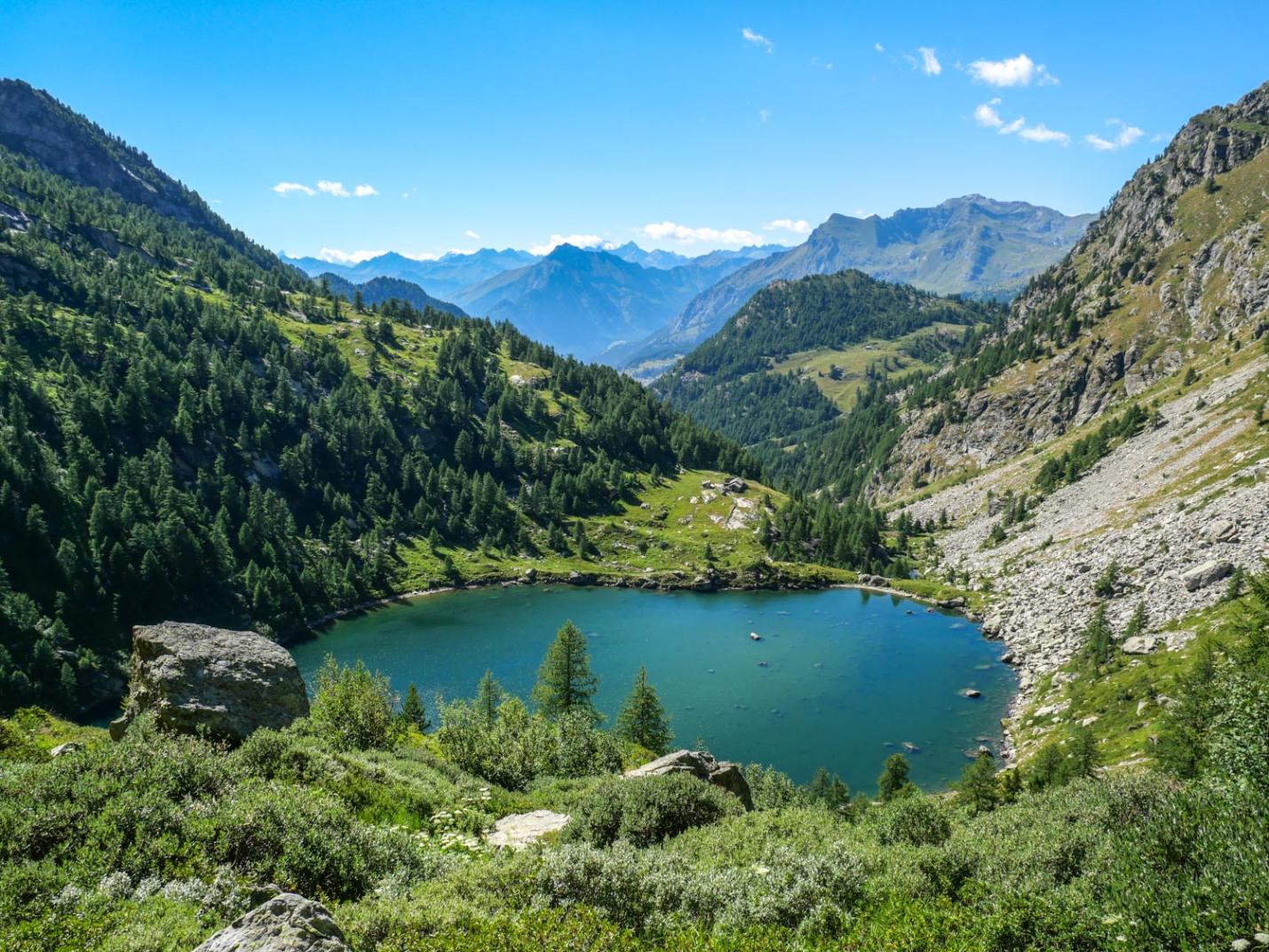
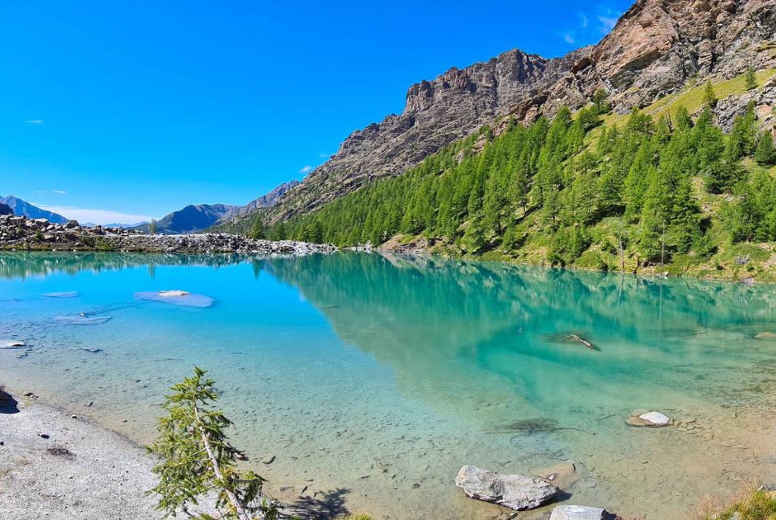
Situated in a basin on the glacial moraine at the base of the Rocca di Verra, the Blue Lake, with its turquoise waters, is in fact a well-known destination. In summer, the little beach along the northern shore can truly be considered a quasi-bathing area in terms of attendance.
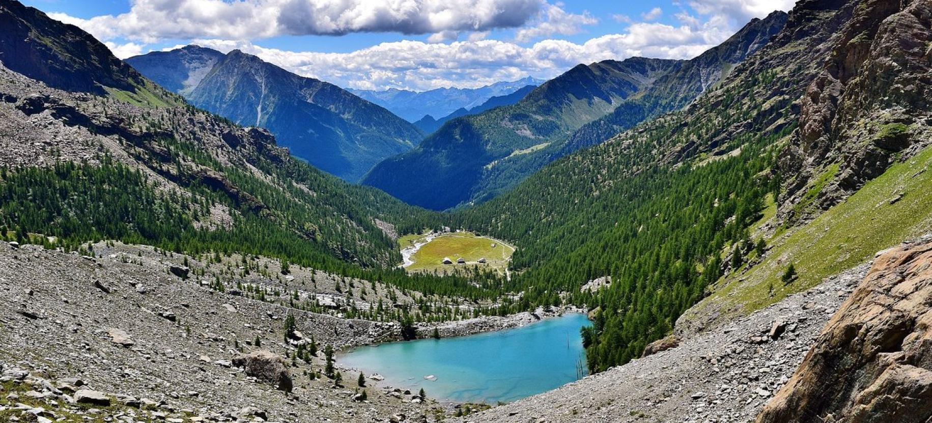
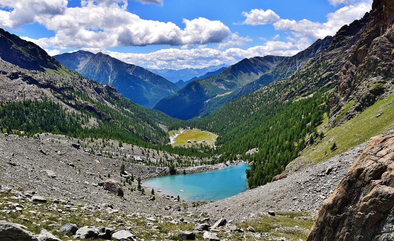
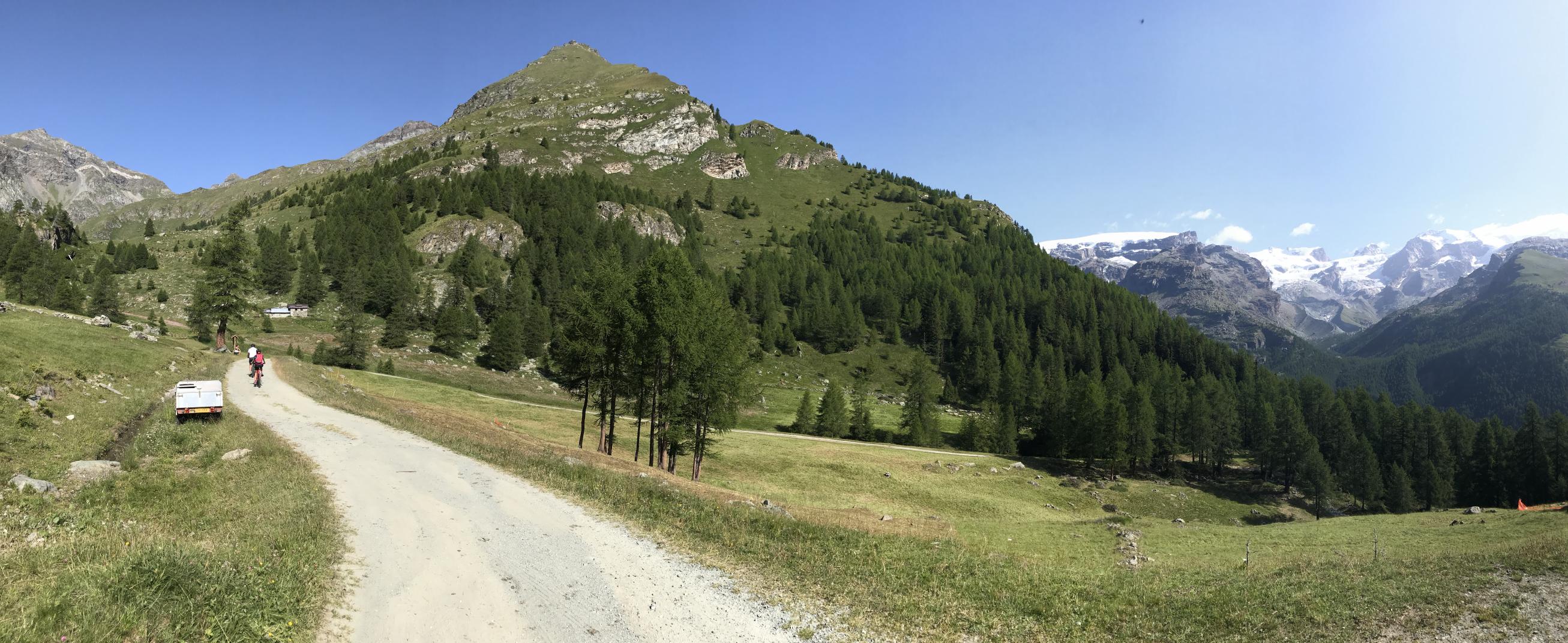
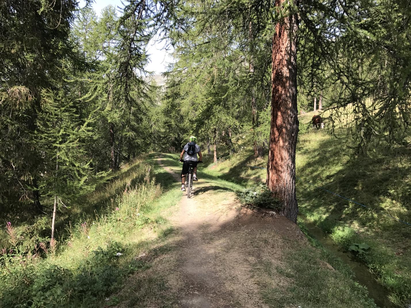
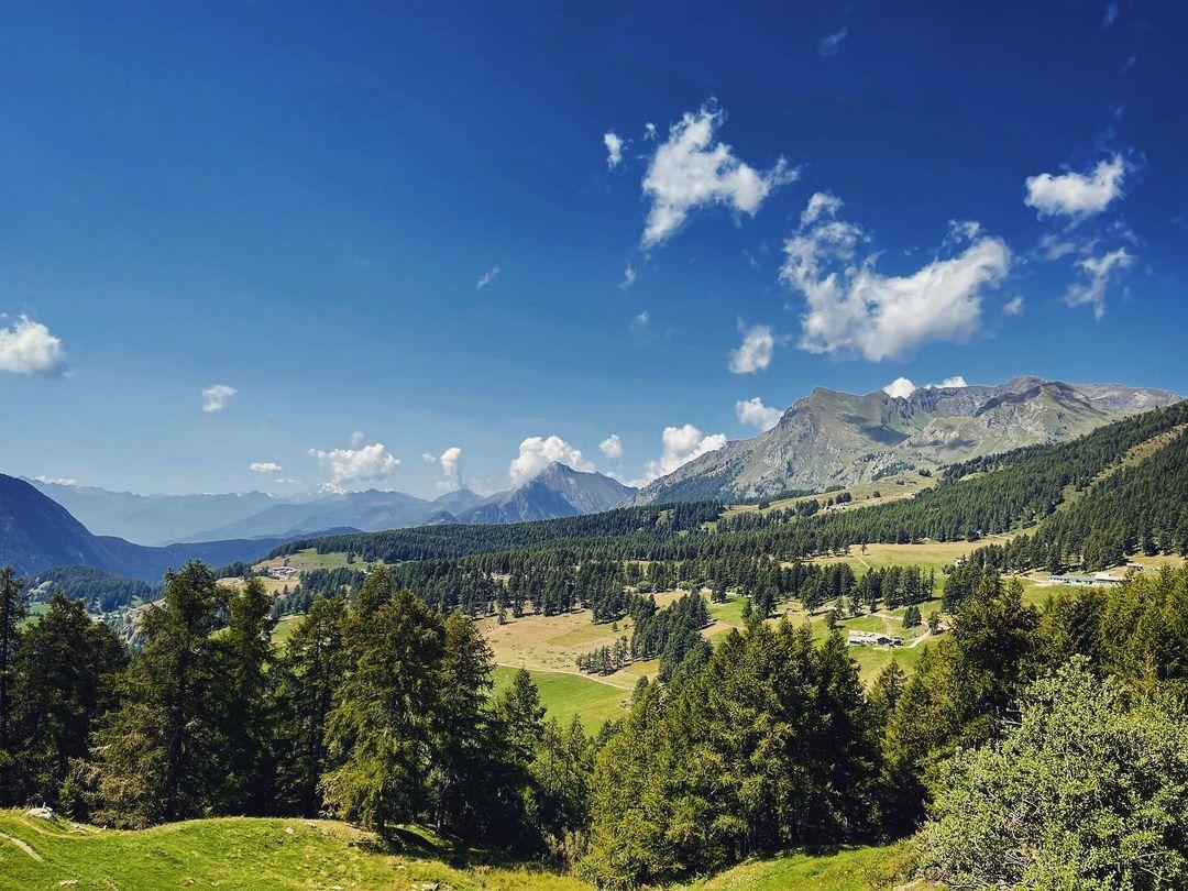
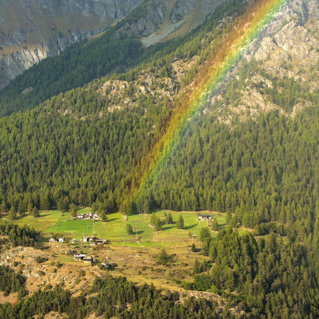
The path to the lake is certainly within everyone's reach, provided they have the minimum amount of training to overcome the small difference in height of just over 500 metres. Along the trail, you pass the hamlets of Fiery - where there is a small bar - and Beaubois and cross the Pian di Verra Inferiore, from where you can enjoy a beautiful panorama of the western part of the Rosa massif, from the Breithorn to the Castore. After the lake, the trail continues over the moraine and joins the dirt road just before it reaches Pian di Verra Superiore, from where the route to the Mezzalama and Guide d'Ayas refuges begins.

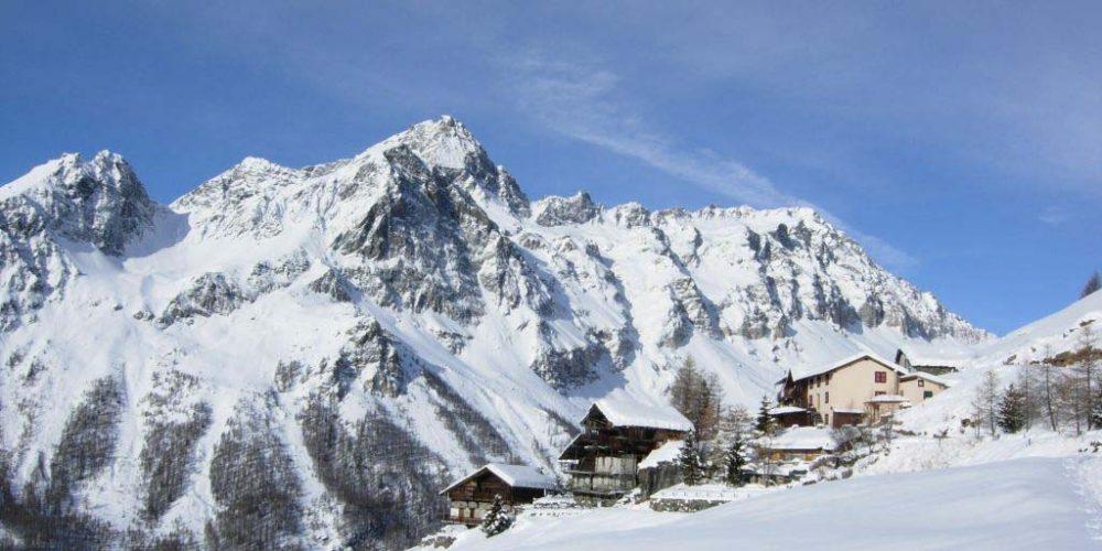
The itinerary is also practicable for the most part in winter, and the Piani di Verra is a classic destination for snowshoe hikers (in many cases using the dirt road instead of the path via Fiery-Beaubois); with due attention to the avalanche risk, even Lago Blu can be reached without too many problems.


Ascent: St.-Jacques m. 1686 - Lower Pian di Verra - Blue Lake m. 2211.

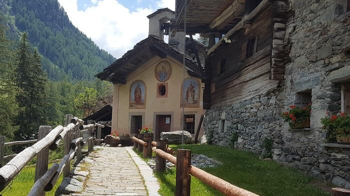
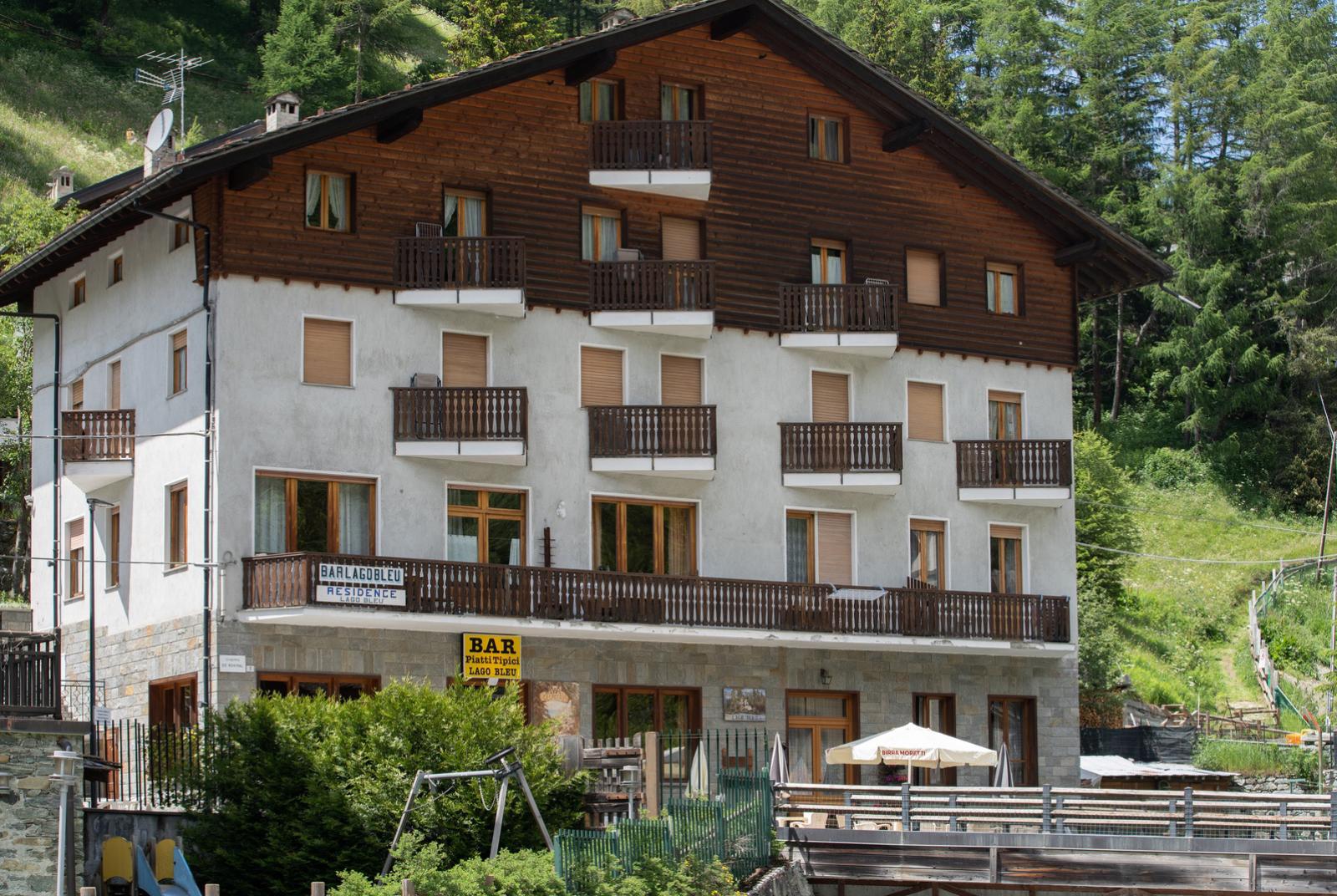
From the little square in St. Jacques, follow the road that, an extension of the state road, climbs up behind the church.
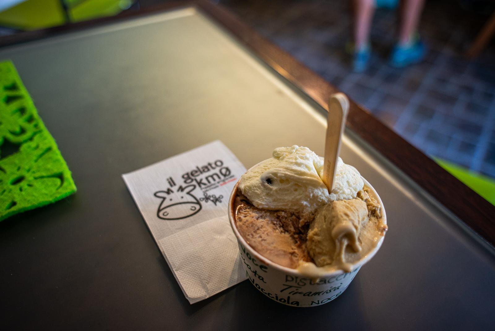
First of all, leave aside the very first diversions to the left, where the hiking signs indicate the start of the paths leading to the Vallone di Nana. Instead, continue uphill on the road which, skirting the orographic left of the Evançon, passes in front of the Fior di Roccia ice-cream parlour and then bends to the left, meeting signs 6,7 and 8.
In a few minutes, you reach a crossroads characterised by the presence of a votive pillar: go straight on, discarding the left branch which, after passing a bridge, is the beginning of the dirt road to the Vallone di Nana.

Note: in the absence of parking spaces, it is sometimes possible to find a few more on this road before the traffic ban, and then take the next bridge to the orographic left.

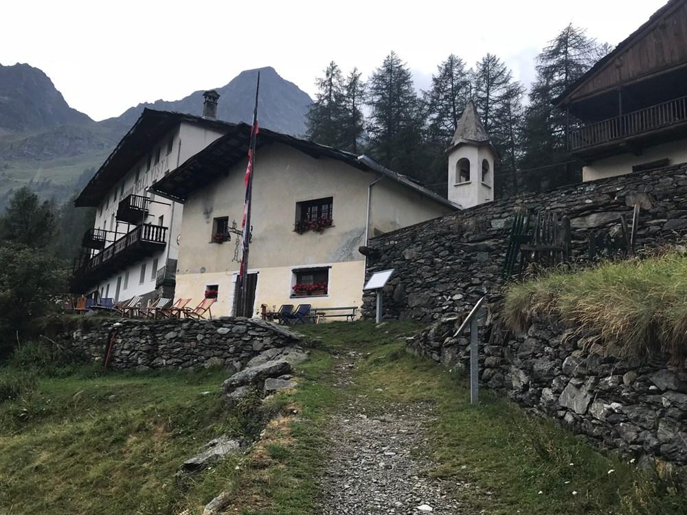
Proceeding straight ahead at the junction with the little chapel, continue up the road along the stream, skirting Blanchard on the opposite bank; at the end, the road bends to the left and crosses the river with a small bridge.
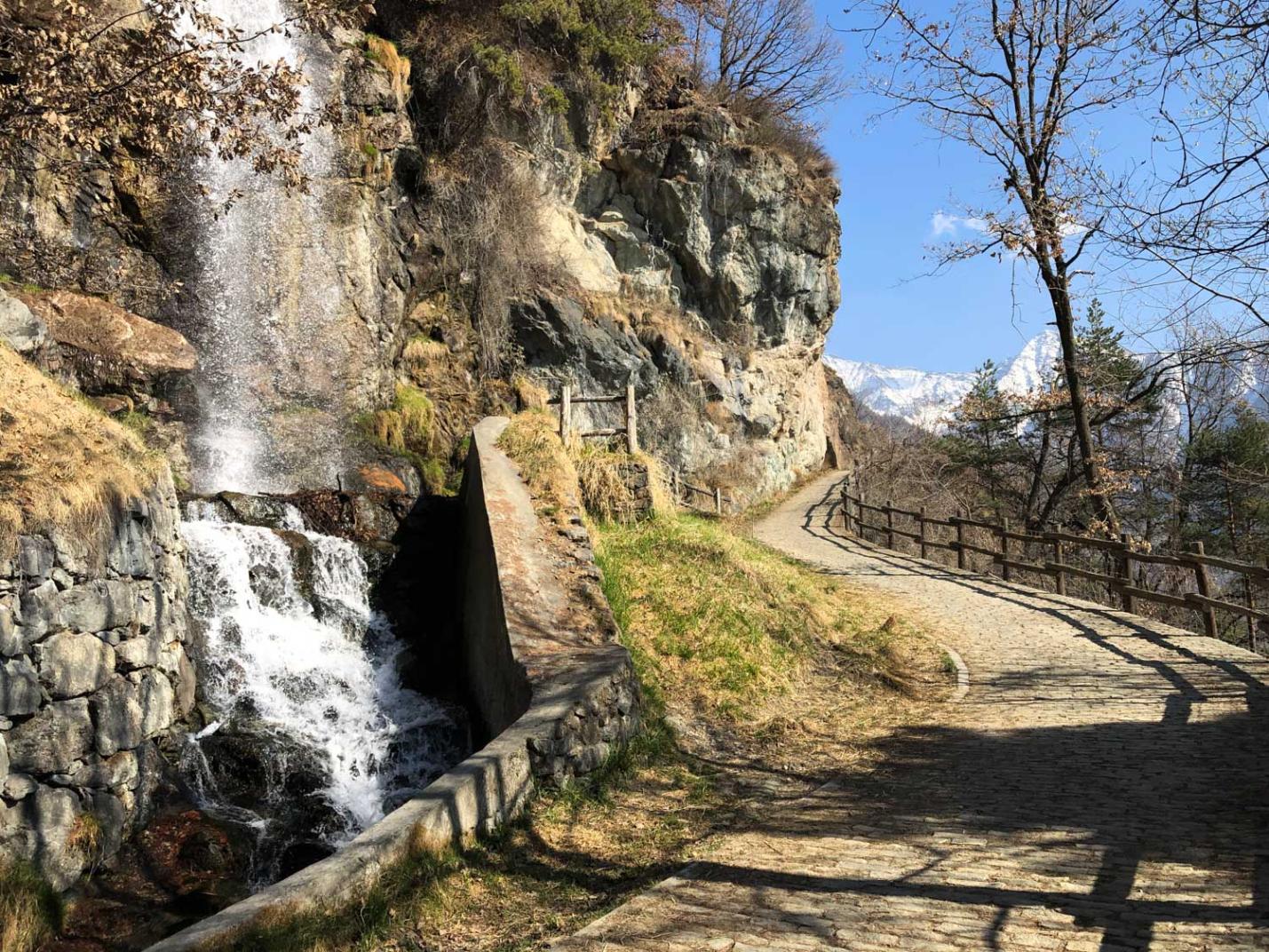
After the bridge, follow the wide paved path to the right that climbs in steps; in this short stretch, you can see the point where the Evançon has its source, at the confluence of the Verra and Cortot torrents, which come from the Piani di Verra and the Vallone delle Cime Bianche respectively.

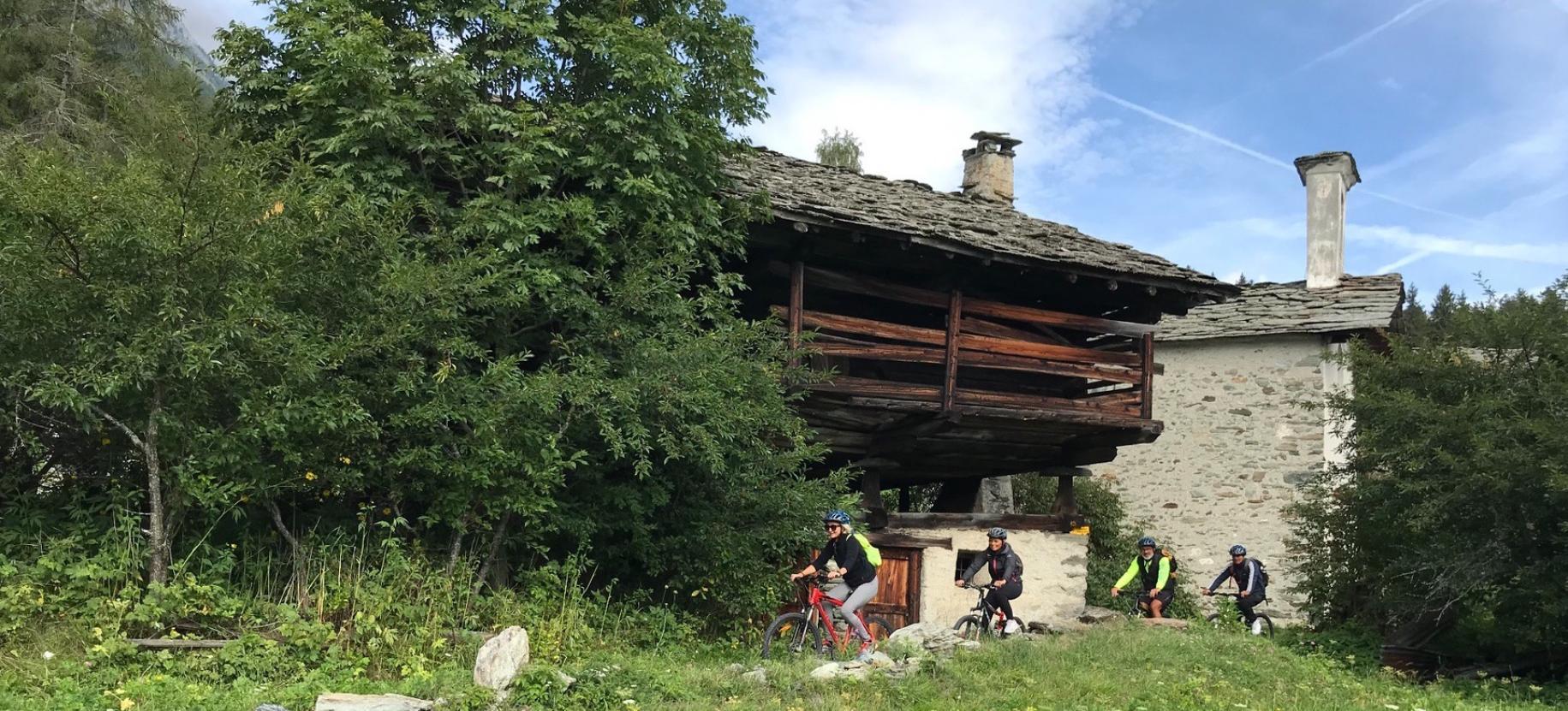
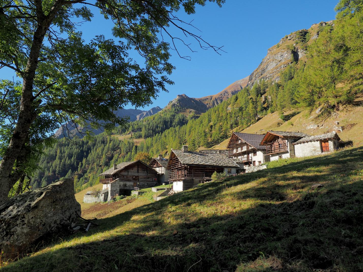
Shortly afterwards, the path emerges from the forest into the green glade of Beaubois; here, stay on the main path, avoiding, in order, the diversions to the right towards the village, the one to the left that, indicated by the GSW (Grande Sentiero Walser) sign, would lead back to Fiery and yet another to the right, marked 8A and GSW, leading to Resy. The correct path, numbered 8, starts to climb again in the forest.
Afterwards, the slope becomes at first less pronounced and then practically nil; a branch-off to the left identified as TMR and 8E is encountered (it leads to the Tzère Valley) but continues straight on.
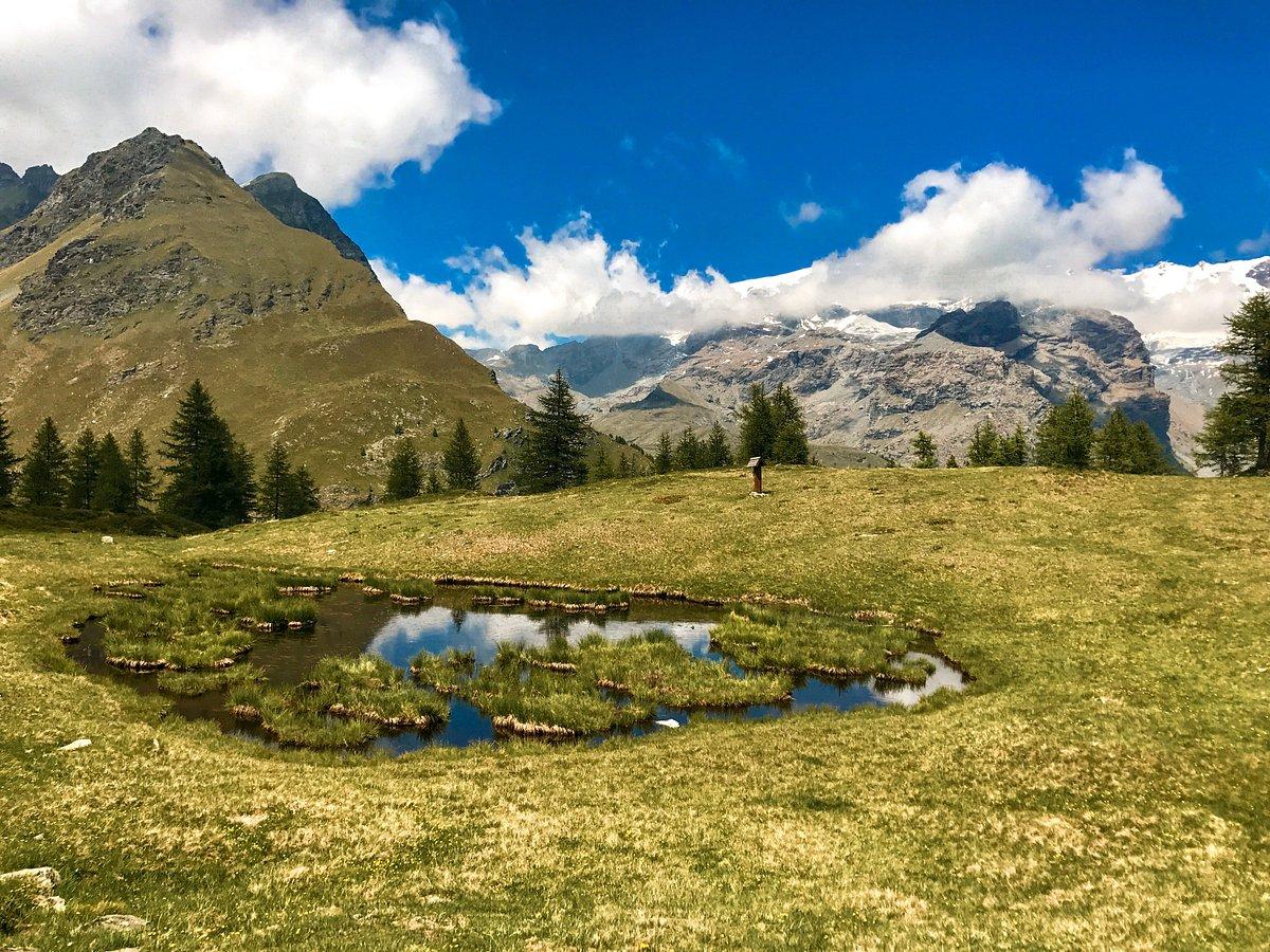
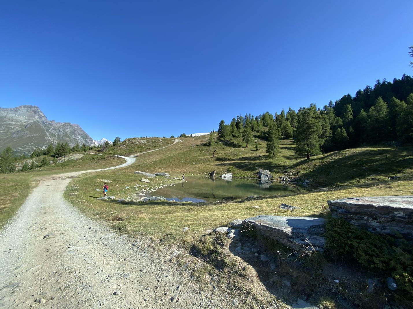
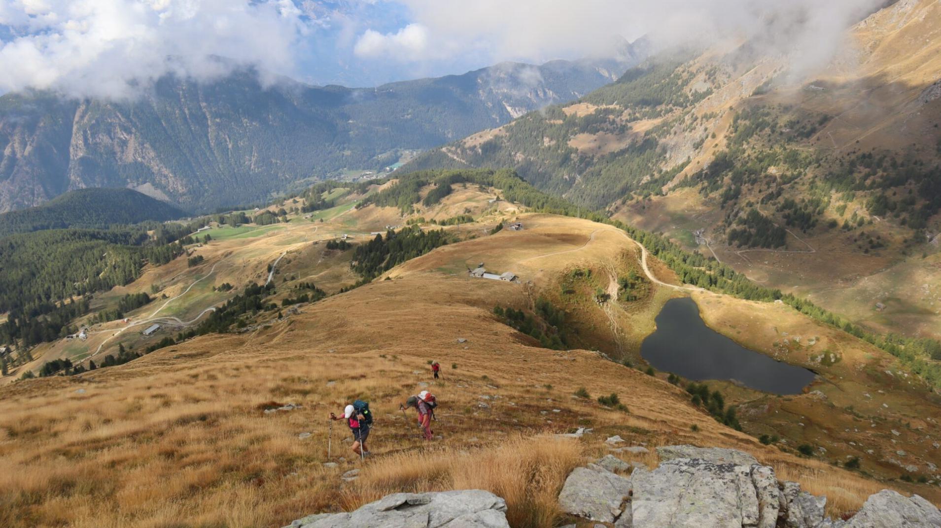
Further on, where the forest begins to thin out, another unnumbered branch off to the left is missed, thus reaching the south end of the Pian di Verra Inferiore.
At the back of a large erratic boulder, the path joins the dirt road that, coming from St.-Jacques, crosses the plateau; this is home to a number of alpine pastures and dwellings, near which, signposted by a small pole, path no. 8 for Colle Bettolina branches off from the road, but for the Blue Lake, you still remain on the main road.
Having reached the northern end of Pian di Verra Inferiore, the road bends to the right and crosses the Torrente di Verra with a bridge; before the bridge and at the bend, the beginning of the final section of the path to the lake, numbered 7 and still marked by vertical signs, is very evident.

Note: there is a drinking water fountain shortly after the bridge.

Remaining on path 7, one begins to climb again along the stream; the ground is composed of earth and stones but poses no particular problems in advancing.
The arrival at the moraine basin that hosts the lake is signalled by the appearance of a stone bridge, recently built, that crosses the lake's outlet: a few metres from the bridge is the southern shore of the Blue Lake.
The lake can be easily circumnavigated, preferably anticlockwise; there is a convenient little beach on the north shore.

Descent: Lago Blu - St.-Jacques.

The descent from Lago Blu to Pian di Verra Inferiore takes place along the same route as the ascent: from the south-western shore of the lake, after crossing the bridge, take path no. 7, which after about 400 metres joins the Pian di Verra Inferiore dirt track where it begins the ascent to Pian di Verra Superiore.
Once on the plateau, cross it in a southerly direction to the point where the road bends slightly to the left; leave it here (unless you want to use it to descend as an alternative to the path) and turn onto the path - indicated by a marker - passing to the right of the large erratic boulder.

Shortly after leaving the Pian di Verra Inferiore, discard the unnumbered diversions to the right and continue on the path that initially descends gently; further on, you will come to the fork where the 8E/TMR path for the Valletta di Tzère begins, but stay on the left-hand branch to reach Beaubois; without leaving the wide, well-marked track, descend to Fiery, turning left at the fork just before the village. The path, now steeper, quickly rejoins the Blanchard area, becoming paved; once past the small wooden bridge, turn left and descend on a stepped mule track until you reach the houses. Once again crossing the stream (which is now the Evançon), you finally meet the paved road and follow it downhill to the starting point of the itinerary, the little square of St.-Jacques.

cartina

lago blu

lago blu

lago blu

lago blu

lago blu

lago blu

lago blu

lago blu

lago blu

lago blu

Details of the tour

Properties

Typology: Trekking

Difficulty: Medium

Ascent: 525 m

Descent: 525 m

Lowest point: 1686 m

Highest point: 2211 m

Duration: 2 hours 40 minutes

Where

Start point
Saint Jacques des Allemands

Get me there

Destination
Saint Jacques des Allemands

Find nearby

Fiery e la Pensione Bellavista: un crocevia di storia

0.46km

Val d'Ayas

In quota

Fiery and the Pensione Bellavista: a crossroad of history

A small cluster of houses dominated by the old Pensione Bellavista, a place full of charm from which to savor an unparalleled view of the entire Ayas Valley.

Altitude: 1878 m

Fraz. Fiery, 11020 Ayas AO

Fiery and the Pensione Bellavista: a crossroad of history

0.47km

Val d'Ayas

In quota

Fiery and the Pensione Bellavista: a crossroad of history

A small cluster of houses dominated by the old Pensione Bellavista, a place full of charm from which to savor an unparalleled view of the entire Ayas Valley.

Altitude: 1878 m

fraz. Fiery, 11020 Ayas AO

Resy

0.85km

Val d'Ayas

In quota

Il villaggio di Resy:on the ancient Walser route

A small group of houses clinging to the mountain, a millennial waypoint on the trail connecting the valleys of Gressoney, Ayas and Valtournenche

Altitude: 2066 m

Resy, 11020 Ayas (AO), 11020 Resy AO

Il villaggio di Resy: sull’antica via Walser

0.88km

Val d'Ayas

In quota

The village of Resy:on the ancient Walser route

A small group of houses clinging to the mountain, a millennial waypoint on the trail connecting the valleys of Gressoney, Ayas and Valtournenche

Altitude: 2066 m

Resy, 11020 Ayas (AO), 11020 Resy AO

Lago di Lochien, tranquillity and unparallaled views

2.07km

Val d'Ayas

In quota

Lago di Lochien, tranquillity and unparallaled views

Set in a corner of the valley far from everything, nestled in the silence of the peaks, the Lake of Lochien is an enchanted place nestled where the forest gives way to the high mountains.

Altitude: 2277 m

Lago di Lochien, quiete e vista ineguagliabile

2.09km

Val d'Ayas

In quota

Lago di Lochien, tranquillity and unparallaled views

Set in a corner of the valley far from everything, nestled in the silence of the peaks, the Lake of Lochien is an enchanted place nestled where the forest gives way to the high mountains.

Altitude: 2277 m

Plan Villy

2.87km

Val d'Ayas

Active

Plan Villy, the oasis of Champoluc

A short walk from the center of Champoluc, the ski lifts and the Monte Rosa SPA Center, an area in which to breathe in all the atmosphere of Monte Rosa

Altitude: 1500 m

Rue de la Traversa 23, 11020 Ayas (AO), 11020 Plan Villy AO

From €5.00

Plan Villy, l’oasi di Champoluc

2.91km

Val d'Ayas

Active

Plan Villy, the oasis of Champoluc

A short walk from the center of Champoluc, the ski lifts and the Monte Rosa SPA Center, an area in which to breathe in all the atmosphere of Monte Rosa

Altitude: 1500 m

Rue de la Traversa 23, 11020 Ayas (AO), 11020 Plan Villy AO

From €5.00

Lago Blu, a turquoise jewel in the ice

3.06km

Val d'Ayas

In quota

Lago Blu, a turquoise jewel in the ice

At the foot of the Rocca di Verra, embraced by the glacier moraine, the Lago Blu, “Blue Lake”, is a must-see destination for those visiting Val d'Ayas.

Altitude: 2200 m

Chemin de Verra, 11020 Ayas AO

Pump Track

3.06km

Val d'Ayas

Active

Pump Track

Chemin de Barmes, Champoluc, 11020 Ayas AO

Bike park - Campo scuola

3.10km

Val d'Ayas

Active

Bike Park - Campo scuola

Chemin des Barmes, Champoluc, 11020 Ayas AO

Basket

3.11km

Val d'Ayas

Active

Campo da Basket

Chemin des Barmes, Champoluc, 11020 Ayas AO

Campi da Padel

3.25km

Val d'Ayas

Active

Campi da Padel

Chemin des Barmes, Champoluc, 11020 Ayas AO

The Hidden Village of Cunéaz

4.51km

Val d'Ayas

Active

The Hidden Village of Cunéaz

An ancient village steeped in history: Cunéaz contains some architectural gems such as its oldest rascard, dating back to the 15th century
Il villaggio nascosto di Cunéaz

4.60km

Val d'Ayas

In quota

The hidden village of Cunéaz

An ancient village rich in history: Cunéaz holds some architectural gems such as its oldest rascard, dating back to the 15th century.

Altitude: 2036 m

Fraz. Cuneaz , 11020 Ayas AO

The hidden village of Cunéaz

4.63km

Val d'Ayas

In quota

The hidden village of Cunéaz

An ancient village rich in history: Cunéaz holds some architectural gems such as its oldest rascard, dating back to the 15th century.

Altitude: 2036 m

Fraz. Cuneaz, 11020 Ayas AO

Mascognaz, dove il tempo si è fermato

4.68km

Val d'Ayas

Active

Mascognaz, where time has stopped

No place concentrates so many magnificent traditional rascards as the village of Mascognaz, a magical place with an atmosphere of yesteryear.
Mascognaz

4.72km

Val d'Ayas

In quota

Mascognaz, where time has stopped

No place concentrates so many magnificent traditional rascards as the village of Mascognaz, a magical place with an atmosphere of yesteryear.

Altitude: 1822 m

Mascognaz, 11020 Ayas (AO), 11020 Ayas AO

Antagnod, vista panoramica da drone

6.68km

Val d'Ayas

Culture

Antagnod Antagnò - Museo Diffuso

l’altare in legno più prezioso della Valle d’Aosta
Lago Perrin

6.69km

Val d'Ayas

In quota

Lago Perrin, in equilibrium among mountain peaks

Practically suspended between rocky peaks and soft slopes, Lake Perrin is a placid body of water with incredible views of the peaks of Monte Rosa

Altitude: 2635 m

11020 Ayas (AO), 11020 Ayas AO

MTB Downhill

2.92km

Val d'Ayas

Active

Verra Glacier brushed with a finger

Perfect route for those who have never tried ebikes, easy and super scenic. Ascent and descent on the same route.

Duration: 2 hours 30 minutes

Length: 8000 m

Difficulty: Low

Lago Blu e vallata

Trekking

3.14km

Val d'Ayas

Active

BLUE LAKE - long tour

CHAMPOLUC - CREST - RESY - PIAN DI VERRA INFERIORE - BLUE LAKE - ST. JACQUES

Duration: 5 hours 10 minutes

Length: 12000 m

Difficulty: Medium

I laghi del Monterosa ski

E-bike

3.53km

Val d'Ayas

Active

The lakes on the Monterosa ski route

Discovering all the lakes that nestle beneath the snow on the ski slopes during winter

Duration: 3 hours

Length: 15000 m

Difficulty: High

Il grande Cult delle escursioni in Mountain bike in Val d'Ayas

E-bike

3.76km

Val d'Ayas

Active

The Great Cult of Mountain Biking in Val d'Ayas

Reaching your first real refuge on an Ebike has never been so much fun.

Duration: 4 hours

Length: 25000 m

Difficulty: Medium

alla scoperta di Ayas villaggi

E-bike

3.77km

Val d'Ayas

Active

AYAS constellation of unique villages

Ayas is a municipality that encompasses many ancient villages, originally connected by characteristic mule tracks.

Duration: 3 hours

Length: 19000 m

Difficulty: Medium

Salomon

Trekking

5.60km

Val d'Ayas

Active

La Pila - Salomon

Duration: 1 hour

Length: 2329 m

Difficulty: Low

Il Ru Courtaud

E-bike

6.20km

Val d'Ayas

Active

Il Ru Courtaud

Duration: 5 hours

Length: 25000 m

Difficulty: Medium

14 tunnels carved into the rock

E-bike

7.35km

Val d'Ayas

Active

14 tunnels carved into the rock

Scenic and Panoramic. The ancient aqueduct, a masterpiece of medieval engineering

Duration: 3 hours

Length: 19000 m

Difficulty: Medium

mountain bike

MTB cross country

7.68km

Val d'Ayas

Active

Bike Itinerary: Circuit Salomon - Col di Joux

on the paths of the Monterosa Prestige

Length: 14100 m

Difficulty: High

Castello di Verrès

E-bike

7.68km

Val d'Ayas

Active

Ciclotour: Saint-Vincent – Col de Joux – Verrès – Saint-Vincent

Duration: 3 hours 4 minutes

Length: 51000 m

Difficulty: Medium

mountain bike

MTB cross country

8.46km

Val d'Ayas

Active

Bike Itinerary: Champoluc - Brusson

on the paths of the Monterosa Prestige

Length: 19290 m

Difficulty: Medium

Corno Bussola

Trekking

11.31km

Val d'Ayas

Active

Pont de Messuere - Lago Bringuez - Corno Bussola

Duration: 4 hours 45 minutes

Difficulty: High

Col de Joux

Trekking

11.43km

Val d'Ayas

Active

Brusson - Col de Joux

A breathtaking view over the Aosta Valley

Duration: 1 hour 3 minutes

Length: 2149 m

Difficulty: Medium

antagnod

E-bike

11.51km

Val d'Ayas

Active

Ciclotour: Brusson - Saint-Jacques - Antagnod - Brusson

Duration: 1 hour 47 minutes

Length: 30700 m

Difficulty: Medium

mountain bike

MTB cross country

11.58km

Val d'Ayas

Active

Bike itinerary: Col de Joux circuit

on the paths of the Monterosa Prestige

Difficulty: High

Laghetto Extrapieraz

Trekking

11.61km

Val d'Ayas

Active

Laghetto di Brusson - Extrepiéraz

Duration: 49 minutes

Length: 2915 m

Difficulty: Low

Corno Bussolaz

Trekking

11.75km

Val d'Ayas

Active

Estoul - Col di Palasinaz - Corno Bussolaz

Duration: 3 hours 40 minutes

Length: 8435 m

Difficulty: High

Arcésaz

Trekking

11.81km

Val d'Ayas

Active

Brusson - Arcésaz

Stroll along the canal Ru d'Arlaz

Duration: 1 hour 6 minutes

Length: 3648 m

Difficulty: Low

Col Tzecore

E-bike

11.85km

Val d'Ayas

Active

Ciclotour: Brusson - Col de Joux - Col Tzecore - Brusson

Duration: 2 hours 9 minutes

Length: 32100 m

Difficulty: Medium

Extrapieraz

Trekking

11.85km

Val d'Ayas

Active

Brusson - Salomon - Extrepiéraz

Duration: 1 hour 35 minutes

Length: 3995 m

Difficulty: Medium

Tour des Six

3.59km

Val d'Ayas

Active

Tour des Six

From €161.00

Jolanda Estate

6.45km

Valle di Gressoney

Active

Trekking at the foot of Monte Rosa Gressoney - Ayas

Three days of panoramic trekking, breathtaking landscapes, a unique excursion.

Loc. Woaldiele 41, 11020 Gressoney-La-Trinite' AO

From €248.00

Capanna Margherita

6.45km

Valle di Gressoney

Adrenaline

Excursion to Capanna Margherita with Alpine Guide

The highest refuge in Europe 4554 m

Località Staffal, 11020 Gressoney La Trinité AO

From €435.00

Happy Trekking Monterosa

7.68km

Active

Happy Trekking in Gressoney

Promotion valid from June 1 to September 15

Villa Deslex, 11025 Gressoney-Saint-Jean AO

Terme Monterosa SPA

2.78km

Val d'Ayas

Wellness

Terme Monterosa SPA

Un oasi di benessere immersa in un panorama mozzafiato

Piazzale Ramey, 1, 11020 Champoluc AO

Farmacia Costa

2.85km

Val d'Ayas

Wellness

Farmacia Costa

Farmacia a Champoluc

Piazzale Ramey, Champoluc, 11020 Ayas AO

Telemark Skiset Ski & Bike Hire

3.14km

Val d'Ayas

Ski

Telemark Skiset Ski & Bike Hire

30 anni di professionalità al vostro servizio

Route Ramey 73 Frazione Champoluc, 11020 Champoluc AO

Ski Rent La Glisse

3.19km

Val d'Ayas

Ski

Ski Rent La Glisse

Comodo noleggio per attrezzatura da sci situato alla partenza della funivia principale di Champoluc
Parco Avventura Champoluc

3.51km

Val d'Ayas

Active

Parco Avventura Champoluc

Società Guide Alpine Champoluc-Ayas Monte Rosa

3.68km

Val d'Ayas

Active

Alpine Guide Company - Champoluc - Ayas Monte Rosa

Your adventure companions on Monte Rosa

Rue des Guides, 3, 11020 Champoluc AO

Ski School Champoluc

3.76km

Val d'Ayas

Ski

Ski School Champoluc

Skiing with professionals in complete safety.

Route Ramey 67 11020 Champoluc Ayas (AO), 11020 Champoluc AO

Scuola Sci Champoluc

3.77km

Val d'Ayas

Ski

Ski School Champoluc

Skiing with professionals in complete safety.

Route Ramey 67 11020 Champoluc Ayas (AO), 11020 Champoluc AO

Libreria Livres et Musique

3.81km

Val d'Ayas

Culture

Libreria Livres et Musique

Libreria di montagna a Champoluc

Route Varasc, 8, 11020 Champoluc AO

Parrucchiere Lostris Hair Studio

3.81km

Val d'Ayas

Wellness

Parrucchiere Lostris Hair Studio

Cura e bellezza del capello

Route Varasc, 10, 11020 Champoluc AO

Negozio dell’Artigianato L’Artisanà

6.27km

Val d'Ayas

In town

Negozio dell’Artigianato L’Artisanà

La vetrina dell'artigianato valdostano ai piedi del Monte Rosa

Rue de l'Eglise - Località Antagnod, 11020 AYAS AO

Scuola Sci Antagnod

6.46km

Val d'Ayas

Ski

Antagnod Ski School

A Ski School for all levels, learning while having fun and in total serenity

Rue Tchavagnod, 6 11020 – Antagnod (AO), 11020 Antagnod AO

Antagnod Ski School

6.47km

Val d'Ayas

Ski

Antagnod Ski School

A Ski School for all levels, learning while having fun and in total serenity

Rue Tchavagnod, 6 11020 – Antagnod (AO), 11020 Antagnod AO

Belin House

9.62km

Val d'Ayas

In town

Belin House

Rue Extrepieraz, 108 , 11022 Brusson AO

Alimentari Math

9.90km

Val d'Ayas

Food

Alimentari Math

Grocery shop

Rue Extrepieraz, 34, 11022 Brusson AO

Vivaio

10.96km

Val d'Ayas

In town

Vivaio - Non solo Fiori

Rue Vollon, 3/BIS, 11022 Brusson AO

Gelateria Arilù

10.96km

Val d'Ayas

Food

Gelateria Arilù

Ice cream shop

Rue Vollon, 74, 11022 Brusson AO

Alimentari

10.99km

Val d'Ayas

Food

Alimentari "Mini Market"

Grocery shop

Rue Vollon, 74, Brusson (AO), 11022 Brusson AO

agrifoglio

11.16km

Val d'Ayas

Food

L'Agrifoglio

Strada Regionale 45, 21 - Vollon , 11022 Brusson AO

ski rental

11.65km

Val d'Ayas

Ski

Ski rental Bruna

Rue Trois Villages, 305, 11022 Brusson AO

Ristorante Fior di Roccia

0.11km

Val d'Ayas

Ristorante Fior di Roccia

Strada Regionale 45, 17 - Saint-Jacques-des-Allemands, 11020 Ayas AO

Ristorante Lago Bleu

0.30km

Val d'Ayas

Ristorante Lago Bleu

Place de la Grotte, Sint-Jacques-des-Allemands, 11020 Ayas AO

Ristorante Rifugio Guide Frachey

0.80km

Val d'Ayas

Ristorante Rifugio Guide Frachey

Loc. Résy, 11020 Ayas AO

Ristorante Rifugio G.B. Ferraro

0.82km

Val d'Ayas

Ristorante Rifugio G.B. Ferraro

Loc. Résy, 11020 Ayas AO

Ristorante La Grange

1.33km

Val d'Ayas

Ristorante La Grange

Chemin de la Crocetta, 2 Frachey, 11020 Ayas AO

Ristorante Bar Tavola Calda Du Soleil

1.38km

Val d'Ayas

Ristorante Bar Tavola Calda Du Soleil

Rue Ciarcierio - Frachey, 11020 Ayas AO

Ristorante Lo Retsignon

1.44km

Val d'Ayas

Ristorante Lo Retsignon

Cucina tipica in alta quota

Loc. Ciarcerio, 11020 Ayas AO

Ristorante Taconet

1.77km

Val d'Ayas

Ristorante Taconet

Località Taconet, Frachey, 11020 Ayas AO

La Maison de Gourmets

1.92km

Val d'Ayas

La Maison de Gourmets

Loc. Frachey, 11020 Ayas AO

La Mandria

1.96km

Val d'Ayas

Ristorante La Mandria

Alpe Ciarcerio, Champoluc, 11020 Ayas AO

Summit Restaurant

2.03km

Val d'Ayas

Summit Restaurant

Strada Regionale 45, 16, Champoluc, 11020 Ayas AO

Ristorante Stadel Soussun

2.12km

Val d'Ayas

Ristorante Stadel Soussun

Località Soussun, 11020 Ayas AO

Pub Ristorante West Road

2.26km

Val d'Ayas

Pub Ristorante West Road

Strada Regionale 45, Frachey, 11020 Ayas AO

Ristorante Le Rocher

2.27km

Val d'Ayas

Ristorante Le Rocher

Loc. Villy 10 , 11020 Ayas AO

Ristorante Petit Tournalin

2.40km

Val d'Ayas

Ristorante Petit Tournalin

Località Villy 2, Frachey, 11020 Ayas AO

Le Petit Coq

2.42km

Val d'Ayas

Ristorante Le Petit Coq

Località Villy, 11020 Ayas AO

Campo Base

2.42km

Val d'Ayas

Campo Base

Col Mon Ros, 11020 Ayas AO

Baita Belvedere

2.80km

Val d'Ayas

Baita Belvedere

Loc. Alpe Saler Superiore n. 1, 11020 Ayas AO

2.84km

Val d'Ayas

Area pic nic "Plan Villy" - Ayas

Plan Villy, 11020 Ayas AO

Ristorante Rifugio Grand Tournalin

2.85km

Val d'Ayas

Ristorante Rifugio Grand Tournalin

Loc. Tournalin Damon, 11020 Ayas AO

Residence Lago Bleu

0.30km

Val d'Ayas

Residence Lago Bleu

Place de la Grotte, Saint-Jacques-des-Allemands, 11020 Ayas AO

Le Petit Chalet Bed&Breakfast

0.39km

Val d'Ayas

Le Petit Chalet Bed&Breakfast

Loc. Chemin de Rovinal, 27/A, Saint-Jacques, 11020 Ayas AO

Hotel Genzianella

0.42km

Val d'Ayas

Hotel Genzianella

Place de la Grotte, 5, Saint-Jacques-des-Allemands, 11020 Ayas AO

HOTEL GENZIANELLA

0.44km

Val d'Ayas

HOTEL GENZIANELLA

Place De La Grotte, 5 - Fraz. Saint-Jacques , CHAMPOLUC AO

Book now

Rifugio Guide Frachey

0.78km

Val d'Ayas

Rifugio Guide di Frachey

Fraz. Resy, 1, 11020 Ayas AO

Rifugio Ferraro

0.83km

Val d'Ayas

Rifugio G.B. Ferraro

Località Resy, 11020 Ayas AO

Hotel California

1.37km

Val d'Ayas

Hotel California

Loc. Frachey, 11020 Champoluc AO

Hotel Monte Cervino

1.42km

Val d'Ayas

Hotel Monte Cervino

Chemin de Soussun 5, 11020 Frachey AO

Hotel Monte Cervino

1.68km

Val d'Ayas

Hotel Monte Cervino

Chemin de Soussun 5, 11020 Frachey - Ayas AO

HOTEL MONTE CERVINO

1.70km

Val d'Ayas

HOTEL MONTE CERVINO

Fraz Frachey, 5 , CHAMPOLUC AO

Book now

Alpine Forest Hotel

1.93km

Val d'Ayas

Alpine Forest Hotel

Località Villy - Frazione Frachey , 11020 Ayas AO

Aethos Monterosa summer

2.07km

Val d'Ayas

Aethos Monterosa

Strada Regionale 45, 16, 11020 Champoluc AO

HOTEL CAMPZERO ACTIVE LUXYURY RESORT

2.10km

Val d'Ayas

HOTEL AETHOS MONTEROSA

Strada Regionale 45, n 16 Champoluc, CHAMPOLUC AO

Book now

Hotel Le Campagnol

2.13km

Val d'Ayas

Hotel Le Campagnol

SR45, 45, Frachey, 11020 Ayas AO

Hotel Le Campagnol

2.15km

Val d'Ayas

Hotel Le Campagnol

SR45, 45, 11020 Frachey AO

Stadel Soussun

2.17km

Val d'Ayas

Hotel Stadel Soussun

Fraz. Soussun - Champoluc, 11020 Ayas AO

Hotel California

2.24km

Val d'Ayas

Hotel California

Loc. Frachey, 11020 Ayas AO

Le Rocher Hotel

2.31km

Val d'Ayas

Le Rocher Hotel

Loc. Villy 10, SR45, 11020 Champoluc - Ayas AO

Hotel Petit Tournalin

2.42km

Val d'Ayas

Hotel Petit Tournalin

Frazione Villy, 2, Champoluc, 11020 Ayas AO

Rifugio Baita Belvedere

2.80km

Val d'Ayas

Rifugio Baita Belvedere

Località Alpe Salere Damon 1, Champoluc, 11020 Ayas AO

On the same topic

Arcésaz

Trekking

Val d'Ayas

Active

Brusson - Arcésaz

Stroll along the canal Ru d'Arlaz

Duration: 1 hour 6 minutes

Length: 3648 m

Difficulty: Low

Col de Joux

Trekking

Val d'Ayas

Active

Brusson - Col de Joux

A breathtaking view over the Aosta Valley

Duration: 1 hour 3 minutes

Length: 2149 m

Difficulty: Medium

Estoul

Trekking

Val d'Ayas

Active

Estoul - Colle Ranzola - Punta Regina

Duration: 2 hours

Length: 4379 m

Difficulty: Medium

Corno Bussola

Trekking

Val d'Ayas

Active

Pont de Messuere - Lago Bringuez - Corno Bussola

Duration: 4 hours 45 minutes

Difficulty: High

Laghi Palasinaz

Trekking

Val d'Ayas

Active

Arp Refuge and Palasinaz lakes

Length: 14500 m

Difficulty: Low

antagnod

E-bike

Val d'Ayas

Active

Ciclotour: Brusson - Saint-Jacques - Antagnod - Brusson

Duration: 1 hour 47 minutes

Length: 30700 m

Difficulty: Medium

14 tunnels carved into the rock

E-bike

Val d'Ayas

Active

14 tunnels carved into the rock

Scenic and Panoramic. The ancient aqueduct, a masterpiece of medieval engineering

Duration: 3 hours

Length: 19000 m

Difficulty: Medium

vollon

Trekking

Val d'Ayas

Active

Brusson - Vollon

Panoramic route discovering Vollon

Duration: 24 minutes

Length: 1263 m

Difficulty: Low

Lago Blu e vallata

Trekking

Val d'Ayas

Active

BLUE LAKE - long tour

CHAMPOLUC - CREST - RESY - PIAN DI VERRA INFERIORE - BLUE LAKE - ST. JACQUES

Duration: 5 hours 10 minutes

Length: 12000 m

Difficulty: Medium

alla scoperta di Ayas villaggi

E-bike

Val d'Ayas

Active

AYAS constellation of unique villages

Ayas is a municipality that encompasses many ancient villages, originally connected by characteristic mule tracks.

Duration: 3 hours

Length: 19000 m

Difficulty: Medium

Castello di Verrès

E-bike

Val d'Ayas

Active

Ciclotour: Saint-Vincent – Col de Joux – Verrès – Saint-Vincent

Duration: 3 hours 4 minutes

Length: 51000 m

Difficulty: Medium

Palasina

Trekking

Val d'Ayas

Active

Tour Le Otto Montagne: hiking to the alpine pastures of Palasinaz

Scenic circular trek

Duration: 7 hours

Difficulty: Medium

I laghi del Monterosa ski

E-bike

Val d'Ayas

Active

The lakes on the Monterosa ski route

Discovering all the lakes that nestle beneath the snow on the ski slopes during winter

Duration: 3 hours

Length: 15000 m

Difficulty: High

Testa di Comagna

E-bike

Val d'Ayas

Active

Ciclotour: Testa di Comagna Tour

Challand-Saint-Victor, Brusson, Emarèse

Length: 28000 m

Difficulty: Medium

Extrapieraz

Trekking

Val d'Ayas

Active

Brusson - Salomon - Extrepiéraz

Duration: 1 hour 35 minutes

Length: 3995 m

Difficulty: Medium

Mont Bieteron

Trekking

Val d'Ayas

Active

Estoul - Mont Bieteron

Duration: 2 hours 50 minutes

Length: 5018 m

Difficulty: High

Salomon

Trekking

Val d'Ayas

Active

La Pila - Salomon

Duration: 1 hour

Length: 2329 m

Difficulty: Low

Laghetto Extrapieraz

Trekking

Val d'Ayas

Active

Laghetto di Brusson - Extrepiéraz

Duration: 49 minutes

Length: 2915 m

Difficulty: Low

Lago Literan

Trekking

Val d'Ayas

Active

Estoul - Lago Literan

Lovely alpine lake in Ayas Valley

Duration: 1 hour 30 minutes

Length: 2800 m

Difficulty: Medium

Rifugio Arp

E-bike

Val d'Ayas

Active

Rifugio Arp with E-bike

Duration: 2 hours 30 minutes

Length: 21000 m

Difficulty: Medium